Features
A road map for mapping
When 10 metres isn’t good enough anymore
May 22, 2023 By Sam Eckart
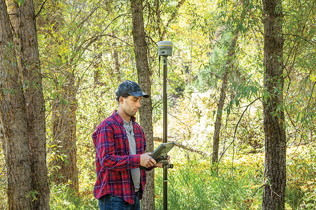 New technology can dramatically improve efficiency. You’ll be able to work faster, more reliably, and more efficiently. Photos courtesy of Trimble.
 Mapping technology has advanced considerably since 2008, which was also the last time the B.C. Ministry of Forestry updated their accuracy requirements. But it’s only a matter of time before rules and regulations get at least within spitting distance of modern technology, which will bring greater accuracy requirements and impact virtually all silvicultural tasks – cut blocks, timber cruising, harvest mapping, and so forth.
Survey videos released as recently as 2021 can be found where key operators are still relying on long-outdated technology. Some forestry professionals are stuck even further back in time, relying on familiar but antiquated chain compasses and paper maps. Even if or when a provider is ready to make the leap to 21st century technology, they frequently don’t leap far enough –choosing outdated GPS devices and mobile devices (tablets) that are still years behind the technology curve.
Old consumer-grade GPS devices still limit you to a 15-30 metre accuracy, which was good enough in 2008, but still well behind leading-edge technology – technology that near-future regulatory changes will almost certainly require.
The dangers of cutting over an inaccurately established cut line are obvious: a potential quagmire of complex legal headaches, delays, and the considerable expenses needed to deal with all of them. The other side of the coin is potentially short-changing yourself. If you have a 10-metre buffer to your cut line and less accurate methods add another 5-10 metres inside of that, you could inadvertently leave a lot of harvestable land (and money) on the table.
Common equipment
The 2008 stalwarts – iPads running mapping software paired with consumer GPS devices — are still popular go-to devices, as are older GNSS (global navigation satellite system) models that only connect to single satellite constellations. Or, they may only connect to a GPS system instead of GNSS systems. In a dense canopy, particularly in mountainous regions of B.C., they could encounter significant difficulty making reliable connections.
Even if you’re using older GNSS systems, newer GNSS options and technological advances can still greatly improve your overall accuracy with stronger, faster connections that deliver better results.
Bottom line: If you can only establish connections to three or fewer satellites from a total of 10 available in open sky, you will not be able to get a position at all. However, if you have up to 30 satellites available, your chances of connecting to four or more increase significantly and you are more likely to get a position – and the more you can see, the more your accuracy will improve.

Mapping technology has advanced considerably since 2008.
So why aren’t people upgrading?
Holdouts aren’t upgrading for three main reasons:
They don’t have to. There are no regulations/requirements to force them to, so why spend thousands of dollars when you can rely on older, cheaper tech?
They don’t know. Some professionals and organizations aren’t aware of what technology is available, or they may be overwhelmed by options.
They don’t want to. Sometimes, old practices get perpetuated from the top-down, where the “top” may be industry veterans sticking to old methods and technology.
So why change now?
While you may not be forced to change, there are plenty of good reasons to get ahead now instead of waiting for regulatory changes to force your hand.
First, new technology can dramatically improve efficiency. You’ll be able to work faster, more reliably, and more efficiently.
You’ll be able to deliver more accurate results with greater confidence, which in turn leads to …
Delivering better, faster, and more accurate outcomes for customers.
Sam Eckart has been a forestry account manager with Cansel since 2020. After completing his degree in geography at the University of Lethbridge, he worked with Alberta Agriculture and Forestry as part of the HAC wildfire team in Fort McMurray.
Print this page